

Canoeing the Texas Colorado River ~ Vernon to Plum
- Scott and Dottie Moore

- Aug 31, 2025
- 4 min read
Here are some pictures and words about 16-1/2 miles of the Texas Colorado River below Smithville, between the Vernon L. Richards Riverbend Park and Plum Park on the Colorado. I like to make an overnight trip of this run.


The pictures above are left to right; October of 2024, January of 2025 and June of 2025. Dave and I made the recon in October. January of 2025 my daughter Rose and I made the trip. My son Leif and I made the trip June of 2025.
For these trips we launched from Vernon L. Richards Riverbend Park.


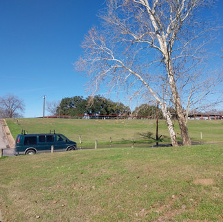


There are two signs to this park. Google Earth nomenclature is in variance to these signs. The access at Vernon's is a class 2. The parking lot is about 100 yards from the bank and the grade is gentle. Rain is unlikely to deteriorate the access.
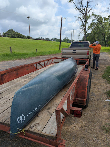
This trip requires a shuttle. Frank Howell provided the June shuttle, we self-supported the January trip and another river company helped us in October.
Below is a map of the run. We camped at the halfway point.

The river was staged at 1.18', 2.19' and 2.41' at the launch of each trip.


The river folks confirmed my observations; the Colorado is permanently three feet low. See the images below of the fishing peer at Vernon's. Left to right the images are from 1997, 2017 and 2022.


Despite low conditions, the river wasn't bony or braided. Lining and portaging the canoe wasn't necessary between the parks. In October we found the riparian vegetation growing down to the new low river levels, encroaching many of the gravel and sandbars. Happily, we found a good campsite.

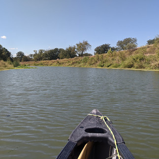
An early start isn't needed for this run. There are some swift places that require coordinated teamwork, but there are no rapids. It's not a stressful canoe trail. We made it to the campsite in three and a half hours or less.
I scouted several potential campsites. Two that I thought were sandbars turned out to be gravel bars.
One of these "sandbars" I named the Dead Bull Sand Bar. In October there was a dead bull at the head of the feature. The "sandbar" looked overgrown. The carcass and buzzards deterred our scouting.
When Rose and I stopped by in January, the carcass had rendered down to a skeleton. The images below are October, January and June.


The buzzards were still present in January.
By June cattle were peacefully cooling where the skeleton had lain and the buzzards were gone. The higher river offered me a glimpsed over the river foliage. When Leif and I scouted we discovered it was a gravel bar. The images below are of the re-named Dead Bull Gravel Bar.


We attributed the clear October water to upstream lake releases and the biofilter plants we saw. We found duckweed, elephant ear plants, water hyacinth, filamentous algae and horsetail ferns (ranunculus fluitans?). These plants hint something is amiss with the water. See the October images below of the water plants.


I suspect lawn and agricultural fertilizers fuel these plants. Dave noted "Wherever the horsetail is the water is very clear." There were fewer of these plants on later trips.
There are more gravel bars than sandbars on this run. The trees are more varied and the cottonwoods are fewer than I am used to.
We saw deer, feral hogs, the usual cranes and herons. Rose spied a coyote. That's a cool sighting!

Each trip we saw bald eagles. Their nests are easily found in the dead of winter. Deer are in the center picture below.


Like other rivers, this piece of the Colorado feels like the Shire of a Tolkien novel. Sprinkled along its banks are weekend homes, private boat ramps and agricultural development. By and by the railroad and the highway sounds drift into the river valley. People-traffic on the river and its banks is light.
All three camps were on the same sandbar. I learned to camp away from the huisache trees, fire ant colonies congregate under them.

Away from the trees the fire ants were manageable.


My sleep gear was not up for the January cold snap, another story... Hours after sunrise my butane powered stove would not warm water. I felt silly, I knew better...

On the June trip, Leif and I kept the canoe minutes ahead of a storm system. The storm caught us right after pitching the tent. We had an interesting couple hours!
Good food turns a rough trip into a better experience.


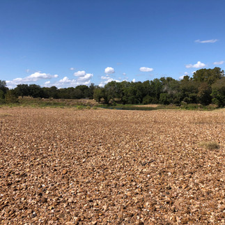
The second reclassified sandbar was down stream from camp. Part of the fun of these trips is confirming the Google Earth images. The "sandbar" across the mouth of Pin Oak Creek turned out to be a massive gravel bar, see the pictures below.


Below are some photos from Pin Oak Creek.


Plum Park on the Colorado River is the take out. A gravel bar, this is a stable class 2 access. The portage trail here can be 100 + yards long but it isn't steep. There is an entrance fee so bring some cash. John Nichols, the park host, keeps the the facility clean and organized. Below are pictures of Plum Park.


Thanks for reading!
Bonus pictures and links to other articles are below.
Canoeing the El Camino Real Paddling Trail
Canoeing the Columbus Paddling Trail

Images of the October trip below.


Below are images from the January launch from Vernon.


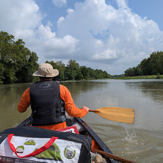
Some views of the June trip.


Comments