

Canoeing the Texas Colorado ~ Plum to La Grange
- Scott and Dottie Moore

- Oct 7, 2025
- 4 min read
Updated: Jan 2
These are the pictures and words of the 18.75 mile recon Geoff and I made in April 2025. We launched into the Texas Colorado River from Plum Park on the Colorado. Our take out was the La Grange highway 71 boat ramp. Frank Howell provided the shuttle.

Like a cloud, every canoe trip is unique. The land, people and weather contribute to the distinct nature of each trip. What was easy, challenging, pleasing or surprising? What went smoothly, or unexpected? Was it class 1, 2 or 3 fun? Am I a better man for making the trip? Will I do it again? Will this trip impact the next one? What is repeatable? What will never be seen again?
Geoff and I made the trip on a Monday and Tuesday. At Smithville the river staged about 1.7' of height. The La Grange gauge held at about 4.3' of height. We got an early start and mild weather held both days. Temperatures ranged from the low 70s to the high 80s with overcast skies. Sustained winds reached 20 mph. Gust were 30 mph. Sometimes the wind was in our faces, other times on our backs. My face got windburned.
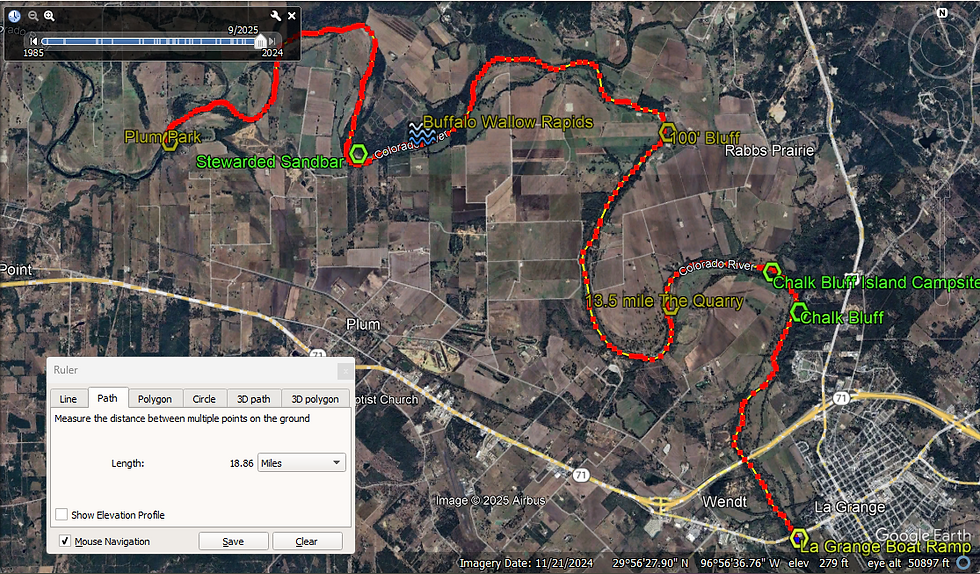
Running the river allows me to verify the curiosities I've studied from Google Earth. Gravel bars and sandbars are novel to me. Once these features are confirmed as a sandbar, I can determine if they suitable for camping. Maybe drought has drawn grass and weeds to overtake them? Is it high enough to be safe? Is it remote and isolated for camping? Maybe its "just" a good place to take an on land break. One sandbar, five miles into the trip looked promising. Setting foot on it resonates with me even now.
If I may, I will share the experience with you.
I call this river feature the Stewarded Sandbar. It's a fantastic, superior sandbar. Standing on it we discovered the tracks of heavy equipment. The machinery was used to improve and maintain the sandbar. I contemplated; Geoff foraged. Far up river, dams tamed the once wild Colorado. Below Smithville, accesses, homes and cattle punctuated the fact that the Colorado runs through a fractured wilderness remnant. I had no wilderness delusions, but seeing a maintained sandbar challenged my world view!
Geoff returned with some dewberries he had picked. "Have some of these!" he said. "This place is fantastic! Too bad its at the beginning of the trip!"
Eating the dewberries I agreed, it was a great sandbar. I mentioned the place being "helped along" by heavy equipment. Geoff responded that the Garden of Eden was not a wilderness or wasteland but a garden, a place of continuity and balance; the fall of man crashed those arcs and upset the equilibrium; man was made to subdue the earth, not conquer the land; the fall did not change our assignment of stewardship and overseeing the land. Geoff's profound and clear understanding of stewardship, his embrace of a sustainable coexistence and cohesion of the realms of nature and the world of men cleared my head.
With months of reflection on that gentle sermon, I know it's true. I've seen natures resilience at Armand Bayou and other places. The banks of Spring Creek testify, along with the west fork of the San Jacinto River, neglected strips of rail road and even Sheldon Reservoir, that the earths resilience is the land's recognition of our first callings and in spite our cracked human state. Even as creation groans under the weight of our sin, it is faithful while we struggle to build, seek beauty and for our redemption.
Enough of my writing.
Below are some pictures, mostly in chronological order, with some words to help them along...kind of like a bulldozer leveling everything out.
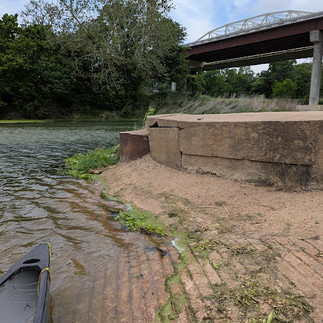
Below, the launch at Plum Park.


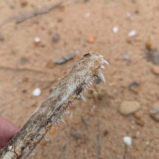
Below, a private access and another critter.


Below are images between Plum and the Stewarded Sandbar.

The overcast sky unfulfilled its rain threat. The results were tolerable temperatures.


The Stewarded Sandbar below.


Some of our finds on the sandbar,


and some views.


Below the Stewarded Sandbar lie the Buffalo Wallow Rapids, a 500 yard long rock garden. I am no good at reading rock gardens! We got hung twice. It wasn't a big deal.

The halfway point.


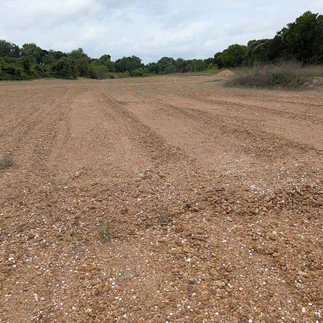
The images left is from the 13.5 mile point. Its position beyond the half way point was ideal for an overnight camp.
From Google Earth it looked promising. After exploring it we named this gravel bar The Quarry. We chanced an island campsite, about 15 miles down from Plum Park.
The island is within view of Chalk Bluff, images are below.


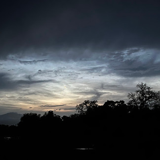
Sunset on Chalk Bluff Island.


Burnt out campfires confirmed the island suitable for camping. Like all easily accessed and beautiful places on the river, others proceeded us. Oddly, neither of us got a picture of Chalk Bluff.


Breaking camp.


La Grange!


On this trip we saw deer, a bald eagle and otters and heard barred owls. Please see the links for related articles. Hope to see you next time.
Thanks for reading!
Recon of the West Fork of the San Jacinto River ~ for an example of nature's resilience...
The Vernon to Plum Run link is below.
The El Camino Real
The Columbus Paddling Trail
Stream Size Definitions


Comments