

The Possum Kingdom, Brazos River Recon
- Scott and Dottie Moore

- Jan 4
- 4 min read

Wednesday, December 17th 2025 my daughter Rose and I left Houston a little after 6:00 am. At 12:45 we pushed our loaded canoe into the clear water of the Palo Pinto County Brazos River, directly below the 16 Bridge and Possum Kingdom Dam. Our take out was 19.5 miles downriver at the 4 Bridge. Rochelle's provided the shuttle.
On the river, fair weather contradicted the four hours of rain we drove in under. For this trip the river was staged a steady 65.8' all three days. This is the normal stage height for the Brazos, steadied by the Possum Kingdom dams throttled release. Wednesday the winds were from the south east. During the day temperatures ranged from the mid sixties. Dawn Thursday saw the low fifties. That day the winds changed, coming out of the north. Friday morning the low was near freezing but the winds switched back to the south east. It was comfortably warm up by noon.


Here the Brazos is a minor/medium stream, running clear and clean. The rugged country it traverses foretells the river's downstream greatness, where it makes its bed in the coastal prairie. This piece of the river was not the Brazos I know, not "my Brazos." This trip was me getting a more complete understanding of the river.

I adjusted the best I could.
With short winter days, a long drive and an after-noon-start, I endeavored to make camp a few miles down from the launch. We lined the canoe a quarter of the distance we paddled. We used rubber boots for the linings. Frequent and multiple linings were the pattern all three days of this trip. By the time we landed on the 3-1/2 mile gravel bar I figured we were unlikely to find a sandbar on this trip.

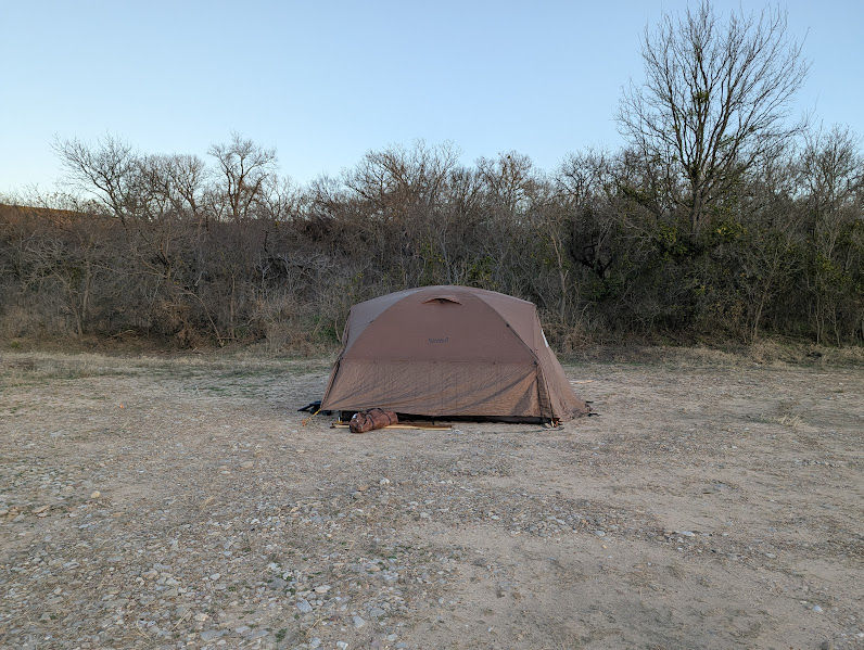
On the 3-1/2 mile gravel bar we pitched our camp on a spot where the gravel was small.


That evening our campfire was from wood we found on the gravel bar. Salt cedar, dry and light, it ignited easily. It burned hotter and longer than the cottonwood, willow and sycamore I am used to. We enjoyed hearing the coyotes that evening.


Thursday morning we ate a quick breakfast with coffee (me) and hot cocoa (Rose). We broke camp and launched by 10:30. The scenery was a different dynamic for us!
For lunch we ate on a gravel bar a little down from the mouth of Ioni Creek.


We made nearly 11 miles the second day. Sometimes we pushed the canoe into the rock garden as far as possible, hoping to make it to the deeper water. Then we lined the canoe only to get back in after a few yards. By the end of the second day we would get back in the canoe when the water poured over our boot tops.

Rose didn't hesitate to line the canoe. She didn't complain about being tired or cold.


My pictures of this trip barely captured the grandeur.
We made it to our second camp by 3:45. Bear in mind the sun set at 5:30.

As with the first campsite, we found evidence of campers at the second site. The second site had been left poorly. We picked it up a little before we departed. Another hash supper, another excellent salt cedar campfire.


After sunset barred owls and coyotes entertained us.


By 11:30 the second night we had frost on the tent. It was still present at 9:00 am on Friday morning.


With the cold morning we stayed in our sleeping bags longer than usual. There were about five miles to end the trip, so...we had a breakfast of bacon, potatoes, coffee and hot cocoa. We were on the river by 11:25.
Later we made the best of my one navigational error. I am no good at reading rock gardens. I selected the right side of an island, which turned out to be the wrong side to run. It was a 500 yard long, very shallow, rock garden. We ate lunch at the head of the largest island, under the view of an escarpment and a bald eagle.

Below, our Friday lunch spot.


The Brazos stayed true to her character to the very end, with rock bluffs, boulders and shallow rock gardens to line. Just upstream of the 4 Bridge we made one last lining. Then we hopped in the canoe and shot the riffle under the bridge. Then we landed at Rochelle's. It was 2:15.

This trip was different for me. The pictures don't accurately portray the countryside. I didn't have to field edit, leave out a piece of fencing, a house, or garbage. I don't exhibit graffiti or dump sites, but there wasn't a concern for those things on this trip. The cleanliness of this section of the Brazos made it easy to stay present.
This kept me engaged with the river, the terrain, and present with my daughter. I "missed" photo opportunities but I made a good trade.
Thanks for reading!
Bonus pictures and links to other articles below.
Brazos River Recon, Beyond the Point of No Return
Canoeing the Texas Colorado ~ Plum to La Grange
Camping & Canoeing the South Llano River
The Vernon to Plum Run link is below.
Stream Size Definitions


Comments